
Kambiyachupa topographic map
Interactive map
Click on the map to display elevation.
About this map
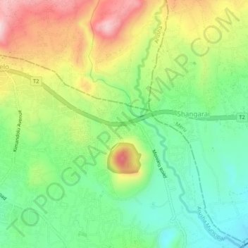
Name: Kambiyachupa topographic map, elevation, terrain.
Location: Kambiyachupa, Arusha Municipal, Arusha, Nordzone, Tansania (-3.39610 36.72759 -3.35610 36.76759)
Average elevation: 1,387 m
Minimum elevation: 1,255 m
Maximum elevation: 1,582 m