
Zarza-Capilla topographic map
Interactive map
Click on the map to display elevation.
About this map
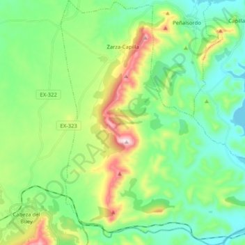
Name: Zarza-Capilla topographic map, elevation, terrain.
Location: Zarza-Capilla, Badajoz, Extremadura, España (38.70765 -5.19720 38.83046 -5.06156)
Average elevation: 504 m
Minimum elevation: 337 m
Maximum elevation: 917 m