Geolocate

Oussudu WLS topographic map

Interactive map

Click on the map to display elevation.

About this map

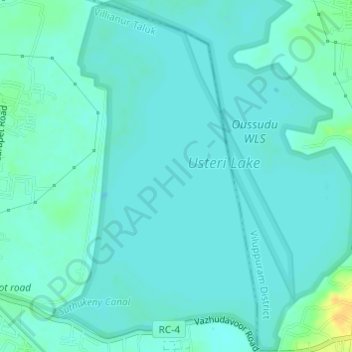
Name: Oussudu WLS topographic map, elevation, terrain.

Location: Oussudu WLS, Vazhudavoor Road, BSNL Staff Quarters, Mettupalayam, Villianur Taluk, Puducherry district, Puducherry, 605010, India (11.93881 79.73143 11.96852 79.75228)

Average elevation: 13 m

Minimum elevation: 8 m

Maximum elevation: 35 m

Other topographic maps

Click on a map to view its topography, its elevation and its terrain.

Puducherry

India > Puducherry > Puducherry Taluk

The topography of Pondicherry is the same as that of coastal Tamil Nadu. Pondicherry's average elevation is at sea level and includes a number of sea inlets, referred to locally as "backwaters". Pondicherry experiences extreme coastal erosion as a result of a breakwater constructed in 1989, just to the south…

Average elevation: 10 m

Veerampattinam

India > Puducherry > Puducherry Taluk

Average elevation: 3 m

Puducherry

India > Puducherry > Puducherry Taluk

The topography of Pondicherry is the same as that of coastal Tamil Nadu. Pondicherry's average elevation is at sea level and includes a number of sea inlets, referred to locally as "backwaters". Pondicherry experiences extreme coastal erosion as a result of a breakwater constructed in 1989, just to the south…

Average elevation: 10 m

moolakulam

India > Puducherry > Ozhukarai Taluk > Oulgaret

Average elevation: 12 m

Yanam

India > Puducherry > Yanam Taluk

In December 1753, a Paravana of Salabat Jang conceded to Bussy the Northern Circars. Salabat Jang was indebted to the French East India Company for his elevation to the throne, which had been confirmed by the Mughal emperor. The agreement made between the French and Salabat Jang in Aurangabad bears the…

Average elevation: 5 m

Ozhukarai Taluk

India > Puducherry

Average elevation: 23 m

Bahour

India > Puducherry > Bahour

Average elevation: 9 m

Villianur Taluk

India > Puducherry

Average elevation: 21 m

Mahe

India > Puducherry > Mahe Taluk

Average elevation: 10 m

Bahour Taluk

India > Puducherry

Average elevation: 7 m

Oulgaret

India > Puducherry > Ozhukarai Taluk

Average elevation: 18 m

Mahe

India > Puducherry > Mahe Taluk

Average elevation: 10 m