
Thank you for supporting this site ❤️
Make a donation
Make a donation
Wufeng Tujia Autonomous County topographic map
Click on the map to display elevation.
Thank you for supporting this site ❤️
Make a donation
Make a donation
About this map
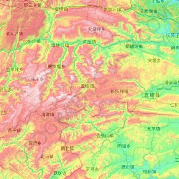
Name: Wufeng Tujia Autonomous County topographic map, elevation, terrain.
Location: Wufeng Tujia Autonomous County, Yichang, Hubei, China (29.94557 110.25026 30.41715 111.35639)
Average elevation: 915 m
Minimum elevation: 72 m
Maximum elevation: 2,246 m
Thank you for supporting this site ❤️
Make a donation
Make a donation
Other topographic maps
Click on a map to view its topography, its elevation and its terrain.