
Vodochody topographic map
Interactive map
Click on the map to display elevation.
About this map
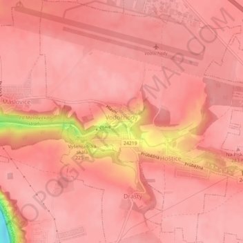
Name: Vodochody topographic map, elevation, terrain.
Location: Vodochody, okres Praha-východ, Central Bohemia, 25069, Czechia (50.19237 14.38302 50.22044 14.42148)
Average elevation: 274 m
Minimum elevation: 172 m
Maximum elevation: 288 m