
Cabana topographic map
Interactive map
Click on the map to display elevation.
About this map
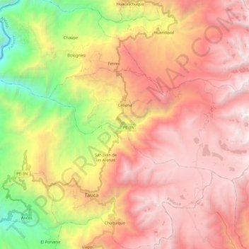
Name: Cabana topographic map, elevation, terrain.
Location: Cabana, Provincia de Pallasca, Áncash, Perú (-8.45798 -78.07569 -8.36145 -77.86047)
Average elevation: 3,296 m
Minimum elevation: 1,329 m
Maximum elevation: 4,800 m