
ハートヤイ topographic map
Interactive map
Click on the map to display elevation.
About this map
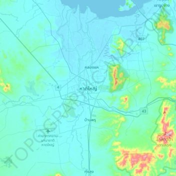
Name: ハートヤイ topographic map, elevation, terrain.
Location: ハートヤイ, บ้านหาร, ソンクラー県, タイ王国 (6.84746 100.30899 7.16746 100.62899)
Average elevation: 47 m
Minimum elevation: -2 m
Maximum elevation: 524 m
Other topographic maps
Click on a map to view its topography, its elevation and its terrain.