
Khamla topographic map
Interactive map
Click on the map to display elevation.
About this map
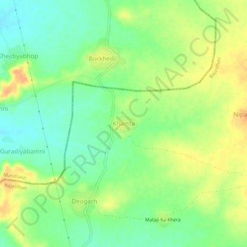
Name: Khamla topographic map, elevation, terrain.
Location: Khamla, Gangdhar Tehsil, Jhalawar District, Rajasthan, India (23.96574 75.73142 24.00574 75.77142)
Average elevation: 482 m
Minimum elevation: 464 m
Maximum elevation: 501 m