
Thank you for supporting this site ❤️
Make a donation
Make a donation
Karu topographic map
Click on the map to display elevation.
Thank you for supporting this site ❤️
Make a donation
Make a donation
About this map
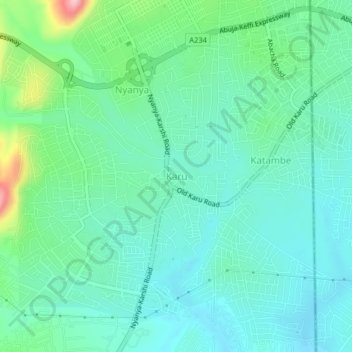
Name: Karu topographic map, elevation, terrain.
Location: Karu, Municipal Area Council, Federal Capital Territory, Nigeria (8.99135 7.55505 9.03135 7.59505)
Average elevation: 422 m
Minimum elevation: 380 m
Maximum elevation: 563 m
Thank you for supporting this site ❤️
Make a donation
Make a donation
Other topographic maps
Click on a map to view its topography, its elevation and its terrain.