
Thank you for supporting this site ❤️
Make a donation
Make a donation
Gangdong-gu topographic map
Click on the map to display elevation.
Thank you for supporting this site ❤️
Make a donation
Make a donation
About this map
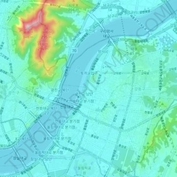
Name: Gangdong-gu topographic map, elevation, terrain.
Location: Gangdong-gu, Seoul, South Korea (37.51679 127.10907 37.58120 127.18377)
Average elevation: 45 m
Minimum elevation: 3 m
Maximum elevation: 327 m
Thank you for supporting this site ❤️
Make a donation
Make a donation