Khuzdar topographic map
Interactive map
Click on the map to display elevation.
About this map
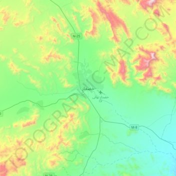
Name: Khuzdar topographic map, elevation, terrain.
Location: Khuzdar, Khuzdar District, Balochistan, 89100, Pakistan (27.64001 66.45665 27.96001 66.77665)
Average elevation: 1,417 m
Minimum elevation: 1,033 m
Maximum elevation: 2,438 m
Khuzdar is at the apex of a narrow valley at an elevation of 1,237 metres (4,058 ft). Despite this altitude, Khuzdar like most of Balochistan has an arid climate (Köppen BWh) with very low and erratic rainfall. Unlike most parts of the province, the heaviest average rainfall comes from the Asian monsoon in July and August, though this rainfall tends to be very erratic and in many summers there is no significant rain at all.
Other topographic maps
Click on a map to view its topography, its elevation and its terrain.
Hub
Pakistan > Balochistan > Hub District
Hub, Hub Tehsil, Hub District, Qalat Division, Balochistan, 90250, Pakistan
Average elevation: 55 m
Quetta City Tehsil
Pakistan > Balochistan > Quetta District
Quetta City Tehsil, Quetta District, Quetta Division, Balochistan, Pakistan
Average elevation: 1,981 m
Kanar
Pakistan > Balochistan > Lasbela District
Kanar, Lasbela District, Balochistan, Pakistan
Average elevation: 286 m
Quetta
Pakistan > Balochistan > Quetta
Quetta, Mastung District, Balochistan, 87300, Pakistan
Average elevation: 1,968 m
Lakhani
Pakistan > Balochistan > Lakhani
Lakhani, Khuzdar District, Balochistan, Pakistan
Average elevation: 1,177 m
Loralai District
Loralai District, Balochistan, Pakistan
Average elevation: 1,416 m
Qilla Abdullah
Pakistan > Balochistan > Qilla Abdullah
Qilla Abdullah, Qila Abdullāh District, Balochistan, 86200, Pakistan
Average elevation: 1,591 m
Hanna Lake
Pakistan > Balochistan > Quetta
Hanna Lake, Quetta Road, Cantonment, Quetta, Ziārat District, Balochistan, 87300, Pakistan
Average elevation: 1,957 m
Loralai
Pakistan > Balochistan > Loralai
Loralai, Loralai District, Balochistan, 84800, Pakistan
Average elevation: 1,433 m