
Patergassen topographic map
Interactive map
Click on the map to display elevation.
About this map
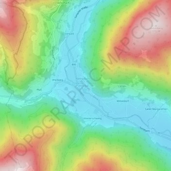
Name: Patergassen topographic map, elevation, terrain.
Average elevation: 1,294 m
Minimum elevation: 1,003 m
Maximum elevation: 1,771 m
Other topographic maps
Click on a map to view its topography, its elevation and its terrain.
Turracher Höhe
Oostenrijk > Karinthië > Reichenau
Turracher Höhe, Reichenau, Bezirk Feldkirchen, Karinthië, 9565, Oostenrijk
Average elevation: 1,870 m