
太平湖镇 topographic map
Interactive map
Click on the map to display elevation.
About this map
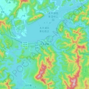
Name: 太平湖镇 topographic map, elevation, terrain.
Location: 太平湖镇, 黄山区, 黄山市, 安徽省, 中国 (30.24794 117.91394 30.40572 118.09211)
Average elevation: 234 m
Minimum elevation: 96 m
Maximum elevation: 806 m
Other topographic maps
Click on a map to view its topography, its elevation and its terrain.