
Thank you for supporting this site ❤️
Make a donation
Make a donation
Adams Run topographic map
Click on the map to display elevation.
Thank you for supporting this site ❤️
Make a donation
Make a donation
About this map
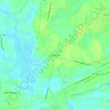
Name: Adams Run topographic map, elevation, terrain.
Location: Adams Run, Charleston County, South Carolina, United States (32.70073 -80.36816 32.74073 -80.32816)
Average elevation: 9 m
Minimum elevation: 2 m
Maximum elevation: 16 m
Thank you for supporting this site ❤️
Make a donation
Make a donation
Other topographic maps
Click on a map to view its topography, its elevation and its terrain.
Mount Pleasant
United States > South Carolina > Charleston County > Mount Pleasant
Average elevation: 3 m