
Helsenhorn topographic map
Interactive map
Click on the map to display elevation.
About this map
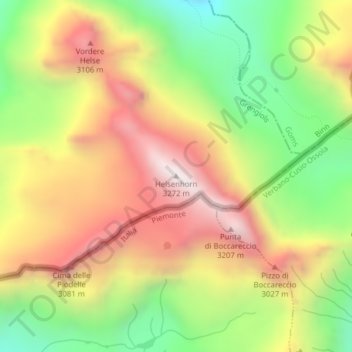
Name: Helsenhorn topographic map, elevation, terrain.
Location: Helsenhorn, Grengiols, Östlich Raron, Vallese, 3993, Svizzera (46.30475 8.19165 46.30485 8.19175)
Average elevation: 2,725 m
Minimum elevation: 2,197 m
Maximum elevation: 3,252 m