
Thank you for supporting this site ❤️
Make a donation
Make a donation
McComb topographic map
Click on the map to display elevation.
Thank you for supporting this site ❤️
Make a donation
Make a donation
About this map
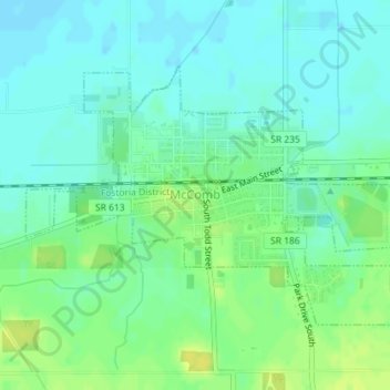
Name: McComb topographic map, elevation, terrain.
Location: McComb, Hancock County, Ohio, United States (41.09849 -83.80832 41.11649 -83.77427)
Average elevation: 232 m
Minimum elevation: 225 m
Maximum elevation: 243 m
Thank you for supporting this site ❤️
Make a donation
Make a donation
Other topographic maps
Click on a map to view its topography, its elevation and its terrain.