
Motobu topographic map
Interactive map
Click on the map to display elevation.
About this map
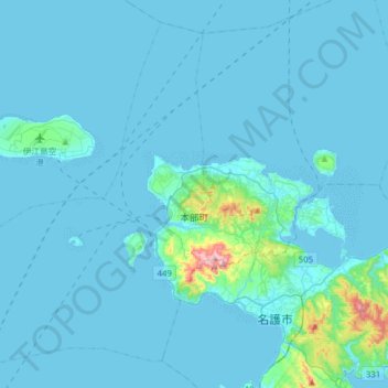
Name: Motobu topographic map, elevation, terrain.
Location: Motobu, Kunigami, Okinawa Prefecture, Japan (26.55722 127.64846 26.80617 127.96285)
Average elevation: 23 m
Minimum elevation: 0 m
Maximum elevation: 429 m
Other topographic maps
Click on a map to view its topography, its elevation and its terrain.
Okinawa Island
Okinawa Island, Ginoza, Kunigami, Okinawa Prefecture, 904-0403, Japan
Average elevation: 20 m