
Hien topographic map
Interactive map
Click on the map to display elevation.
About this map
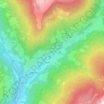
Name: Hien topographic map, elevation, terrain.
Average elevation: 1,456 m
Minimum elevation: 998 m
Maximum elevation: 2,142 m
Other topographic maps
Click on a map to view its topography, its elevation and its terrain.
Gerin
Italië > Trentino-Zuid-Tirol > Bolzano - Bozen > Sarntal - Sarentino > Reinswald - San Martino
Gerin, Reinswald - San Martino, Sarntal - Sarentino, Salten-Schlern - Salto-Sciliar, Bolzano - Bozen, Trentino-Zuid-Tirol, 39058, Italië
Average elevation: 1,620 m