
Thank you for supporting this site ❤️
Make a donation
Make a donation
Saint Quentin Parish topographic map
Click on the map to display elevation.
Thank you for supporting this site ❤️
Make a donation
Make a donation
About this map
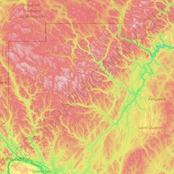
Name: Saint Quentin Parish topographic map, elevation, terrain.
Average elevation: 341 m
Minimum elevation: 58 m
Maximum elevation: 647 m
Thank you for supporting this site ❤️
Make a donation
Make a donation
Other topographic maps
Click on a map to view its topography, its elevation and its terrain.
Saint Andrews
Canada > New Brunswick > Charlotte County > Town of Saint Andrews
Average elevation: 7 m