
Thank you for supporting this site ❤️
Make a donation
Make a donation
Kiti topographic map
Click on the map to display elevation.
Thank you for supporting this site ❤️
Make a donation
Make a donation
Kiti
Kiti or Keti (Persian: کیتی), is a district in Daykundi province in central Afghanistan. It was created in 2005 from the former Kajran district. The main village Kiti is at 1,783 m altitude.
Thank you for supporting this site ❤️
Make a donation
Make a donation
About this map
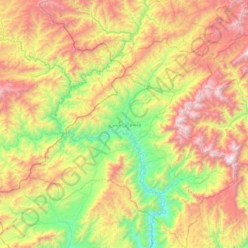
Name: Kiti topographic map, elevation, terrain.
Location: Kiti, Daykundi Province, Afghanistan (33.26820 65.37768 33.85293 65.98636)
Average elevation: 2,365 m
Minimum elevation: 1,303 m
Maximum elevation: 3,977 m
Thank you for supporting this site ❤️
Make a donation
Make a donation
Other topographic maps
Click on a map to view its topography, its elevation and its terrain.