
Thank you for supporting this site ❤️
Make a donation
Make a donation
Heemskerk topographic map
Click on the map to display elevation.
Thank you for supporting this site ❤️
Make a donation
Make a donation
About this map
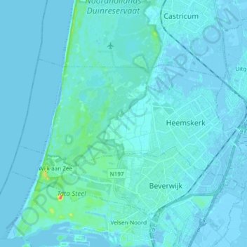
Name: Heemskerk topographic map, elevation, terrain.
Location: Heemskerk, Noord-Holland, Nederland (52.48633 4.57149 52.53389 4.72037)
Average elevation: 3 m
Minimum elevation: -4 m
Maximum elevation: 48 m
Thank you for supporting this site ❤️
Make a donation
Make a donation