
Thank you for supporting this site ❤️
Make a donation
Make a donation
Alberton topographic map
Click on the map to display elevation.
Thank you for supporting this site ❤️
Make a donation
Make a donation
Alberton
Alberton lies at an elevation of approximately 1,570 m (5,150 ft) above sea level on the banks of the Natal Spruit, approximately 11 km south-east of Johannesburg CBD, 59 km south of Pretoria and 49 km north-east of Vereeniging. Organisationally and administratively, it is included in the City of Ekurhuleni Metropolitan Municipality.
Thank you for supporting this site ❤️
Make a donation
Make a donation
About this map
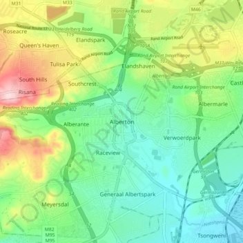
Name: Alberton topographic map, elevation, terrain.
Average elevation: 1,628 m
Minimum elevation: 1,534 m
Maximum elevation: 1,786 m
Thank you for supporting this site ❤️
Make a donation
Make a donation