
Dandeli topographic map
Interactive map
Click on the map to display elevation.
About this map
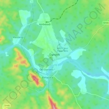
Name: Dandeli topographic map, elevation, terrain.
Average elevation: 480 m
Minimum elevation: 433 m
Maximum elevation: 623 m
Dandeli is located at 15.247719N, 74.629678W. It has an average elevation of 473 metres (1,552 ft) and has received heavy rainfall during August to November (see chart below). Because of good forest cover and moderate elevation, the location has a tropical highland climate, averaging about 27 °C (81 °F) in summer and 18 °C (64 °F) in winter.