
Ribeira dos Azinhais topographic map
Interactive map
Click on the map to display elevation.
About this map
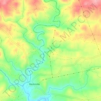
Name: Ribeira dos Azinhais topographic map, elevation, terrain.
Average elevation: 240 m
Minimum elevation: 177 m
Maximum elevation: 310 m
Other topographic maps
Click on a map to view its topography, its elevation and its terrain.
São Pedro do Esteval
Portugal > Castelo Branco > São Pedro do Esteval > São Pedro do Esteval
São Pedro do Esteval, Proença-a-Nova, Castelo Branco, Portugal
Average elevation: 224 m