
Thank you for supporting this site ❤️
Make a donation
Make a donation
Biensdorf topographic map
Click on the map to display elevation.
Thank you for supporting this site ❤️
Make a donation
Make a donation
Biensdorf
Biensdorf liegt auf dem Höhenzug zwischen Seidewitz und Müglitz etwa 5 km nördlich von Liebstadt.
Thank you for supporting this site ❤️
Make a donation
Make a donation
About this map
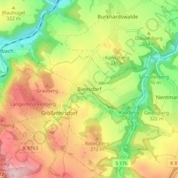
Name: Biensdorf topographic map, elevation, terrain.
Average elevation: 312 m
Minimum elevation: 190 m
Maximum elevation: 446 m
Thank you for supporting this site ❤️
Make a donation
Make a donation