
Thank you for supporting this site ❤️
Make a donation
Make a donation
Le Château topographic map
Click on the map to display elevation.
Thank you for supporting this site ❤️
Make a donation
Make a donation
About this map
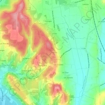
Name: Le Château topographic map, elevation, terrain.
Average elevation: 211 m
Minimum elevation: 155 m
Maximum elevation: 286 m
Thank you for supporting this site ❤️
Make a donation
Make a donation
Other topographic maps
Click on a map to view its topography, its elevation and its terrain.
Mercurol
France > Auvergne-Rhône-Alpes > Drôme > Mercurol-Veaunes
Dictionnaire topographique du département de la Drôme.
Average elevation: 180 m
Veaunes
France > Auvergne-Rhône-Alpes > Drôme > Mercurol-Veaunes
Dictionnaire topographique du département de la Drôme.
Average elevation: 202 m