
Pothepalle topographic map
Interactive map
Click on the map to display elevation.
About this map
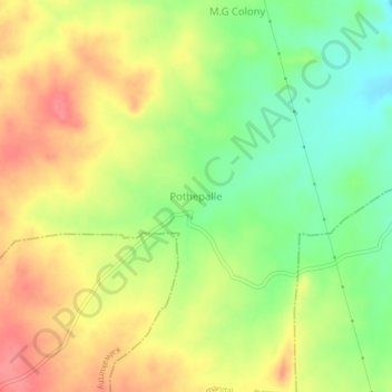
Name: Pothepalle topographic map, elevation, terrain.
Average elevation: 453 m
Minimum elevation: 415 m
Maximum elevation: 489 m
Other topographic maps
Click on a map to view its topography, its elevation and its terrain.
Veldanda
India > Telangana > Veldanda mandal
Veldanda, Veldanda mandal, Nagarkurnool, Telangana, 509360, India
Average elevation: 491 m