Geolocate

Bargersville topographic map

Interactive map

Click on the map to display elevation.

About this map

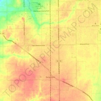
Name: Bargersville topographic map, elevation, terrain.

Location: Bargersville, Johnson County, Indiana, 46106, United States (39.50955 -86.25076 39.57762 -86.13911)

Average elevation: 243 m

Minimum elevation: 203 m

Maximum elevation: 262 m

Other topographic maps

Click on a map to view its topography, its elevation and its terrain.

Nineveh

United States > Indiana > Johnson County

Nineveh, Johnson County, Indiana, United States

Average elevation: 238 m

Trafalgar

United States > Indiana > Johnson County

Trafalgar, Johnson County, Indiana, United States

Average elevation: 257 m

Greenwood

United States > Indiana > Johnson County

Greenwood, Johnson County, Indiana, United States

Average elevation: 245 m

Edinburgh

United States > Indiana > Johnson County

Edinburgh, Johnson County, Indiana, United States

Average elevation: 205 m

Stones Crossing

United States > Indiana > Johnson County > Greenwood

Stones Crossing, Greenwood, Johnson County, Indiana, 46143, United States

Average elevation: 238 m

Green Valley

United States > Indiana > Johnson County > Greenwood

Green Valley, Greenwood, Johnson County, Indiana, 46143, United States

Average elevation: 239 m

Franklin

United States > Indiana > Johnson County

Franklin, Johnson County, Indiana, 46131, United States

Average elevation: 230 m