
Thank you for supporting this site ❤️
Make a donation
Make a donation
Mbirikani topographic map
Click on the map to display elevation.
Thank you for supporting this site ❤️
Make a donation
Make a donation
About this map
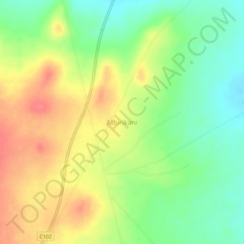
Name: Mbirikani topographic map, elevation, terrain.
Location: Mbirikani, Kajiado County, Kenya (-2.55330 37.51330 -2.51330 37.55330)
Average elevation: 1,208 m
Minimum elevation: 1,177 m
Maximum elevation: 1,242 m
Thank you for supporting this site ❤️
Make a donation
Make a donation
Other topographic maps
Click on a map to view its topography, its elevation and its terrain.