
JATWARA topographic map
Interactive map
Click on the map to display elevation.
About this map
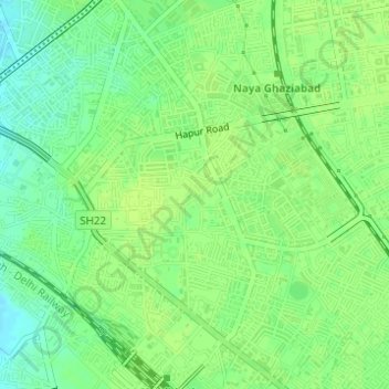
Name: JATWARA topographic map, elevation, terrain.
Location: JATWARA, Ghaziabad, Uttar Pradesh, 201001, India (28.65598 77.42126 28.67598 77.44126)
Average elevation: 215 m
Minimum elevation: 206 m
Maximum elevation: 218 m
Other topographic maps
Click on a map to view its topography, its elevation and its terrain.
Indirapuram
India > Uttar Pradesh > Ghaziabad
Indirapuram, Ghaziabad, Uttar Pradesh, 201001, India
Average elevation: 204 m
B Block Park Ramprastha Colony
India > Uttar Pradesh > Ghaziabad
B Block Park Ramprastha Colony, Chander Nagar, Kaushambi, Ghaziabad, Uttar Pradesh, 201001, India
Average elevation: 206 m
Teacher Colony
India > Uttar Pradesh > Ghaziabad
Teacher Colony, Ghaziabad, Uttar Pradesh, 201001, India
Average elevation: 208 m
Patel Nagar
India > Uttar Pradesh > Ghaziabad
Patel Nagar, Ghaziabad, Uttar Pradesh, 201001, India
Average elevation: 212 m