
Matt topographic map
Interactive map
Click on the map to display elevation.
About this map
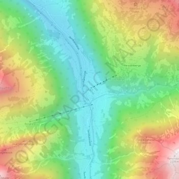
Name: Matt topographic map, elevation, terrain.
Location: Matt, Glarus Süd, Glarus, 8766, Schweiz (46.93970 9.15104 46.97970 9.19104)
Average elevation: 1,331 m
Minimum elevation: 788 m
Maximum elevation: 2,218 m
Der Bau der Luftseilbahn Matt-Weissenberge (LMW) im Jahr 1967 hat zu einer touristischen Entwicklung von Matt und den höher gelegenen Gemeindeteilen geführt. Die sonnige Geländeterrasse auf einer Höhe von 1300 m ist ein Ausflugsziel und Ferienort. Vom Chrauchtal führt ein Wanderweg über den Risetenpass (2189 m ü. M.) ins Weisstannental.