
San Zenon topographic map
Interactive map
Click on the map to display elevation.
About this map
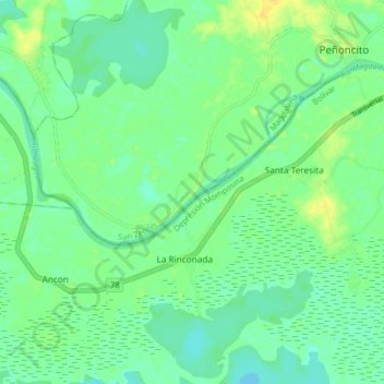
Name: San Zenon topographic map, elevation, terrain.
Location: San Zenon, San Zenón, Magdalena, Colombia (9.20488 -74.53843 9.28488 -74.45843)
Average elevation: 19 m
Minimum elevation: 10 m
Maximum elevation: 31 m