
Thank you for supporting this site ❤️
Make a donation
Make a donation
Merwin topographic map
Click on the map to display elevation.
Thank you for supporting this site ❤️
Make a donation
Make a donation
About this map
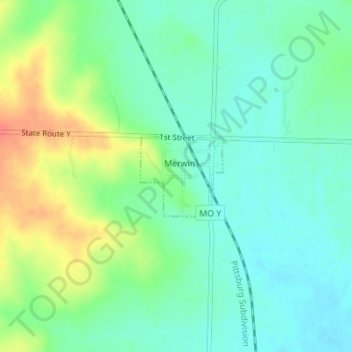
Name: Merwin topographic map, elevation, terrain.
Location: Merwin, Bates County, Missouri, United States (38.40062 -94.59493 38.40685 -94.58680)
Average elevation: 282 m
Minimum elevation: 264 m
Maximum elevation: 316 m
Thank you for supporting this site ❤️
Make a donation
Make a donation
Other topographic maps
Click on a map to view its topography, its elevation and its terrain.