
Thana Kasba topographic map
Interactive map
Click on the map to display elevation.
About this map
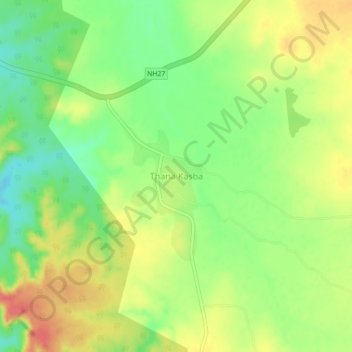
Name: Thana Kasba topographic map, elevation, terrain.
Location: Thana Kasba, Shahbad Tehsil, Baran District, Rajasthan, Indien (25.19638 77.33452 25.23638 77.37452)
Average elevation: 397 m
Minimum elevation: 366 m
Maximum elevation: 430 m