
Friedrichroda topographic map
Interactive map
Click on the map to display elevation.
About this map
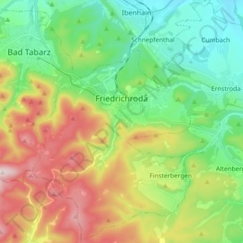
Name: Friedrichroda topographic map, elevation, terrain.
Location: Friedrichroda, Landkreis Gotha, Thüringen, 99894, Deutschland (50.81300 10.51583 50.89361 10.64591)
Average elevation: 495 m
Minimum elevation: 319 m
Maximum elevation: 803 m