
Yera topographic map
Interactive map
Click on the map to display elevation.
About this map
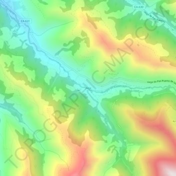
Name: Yera topographic map, elevation, terrain.
Location: Yera, Vega de Pas, Cantabria, Cantabrie, 39685, Espagne (43.11541 -3.77592 43.15541 -3.73592)
Average elevation: 677 m
Minimum elevation: 352 m
Maximum elevation: 1,189 m
Other topographic maps
Click on a map to view its topography, its elevation and its terrain.
Cutil
Espagne > Cantabria > Vega de Pas
Cutil, Vega de Pas, Valles Pasiegos, Cantabria, Cantabrie, 39685, Espagne
Average elevation: 585 m