
Darwen topographic map
Interactive map
Click on the map to display elevation.
About this map
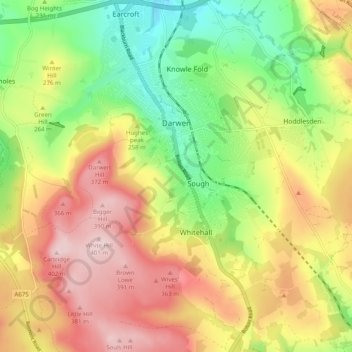
Name: Darwen topographic map, elevation, terrain.
Location: Darwen, Blackburn with Darwen, Angleterre, Royaume-Uni (53.65787 -2.50286 53.71654 -2.42305)
Average elevation: 259 m
Minimum elevation: 123 m
Maximum elevation: 402 m
Other topographic maps
Click on a map to view its topography, its elevation and its terrain.
Blackburn
Royaume-Uni > Angleterre > Blackburn with Darwen
Blackburn, Blackburn with Darwen, Angleterre, BB1 7DP, Royaume-Uni
Average elevation: 157 m