
Make a donation
Trapani topographic map
Click on the map to display elevation.
Make a donation
Trapani
Much of the built-up peninsula is very low-lying, with the city’s average elevation around 3 m above sea level. To the north a strip of sandy beach runs below the Mura di Tramontana at the edge of the historic centre, while to the south the urban area gives way to the low-lying salt-pans and wetlands of the Trapani–Paceco reserve. This combination of low relief, beaches and saline basins has encouraged modern expansion mainly eastwards along the Via G.B. Fardella axis on the landward side of the peninsula.
Make a donation
About this map
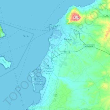
Name: Trapani topographic map, elevation, terrain.
Location: Trapani, Sicily, 91100, Italy (37.83681 12.43849 38.04349 12.80085)
Average elevation: 56 m
Minimum elevation: -2 m
Maximum elevation: 756 m
Make a donation
Other topographic maps
Click on a map to view its topography, its elevation and its terrain.
Make a donation
Make a donation