
Thank you for supporting this site ❤️
Make a donation
Make a donation
Atmore topographic map
Click on the map to display elevation.
Thank you for supporting this site ❤️
Make a donation
Make a donation
About this map
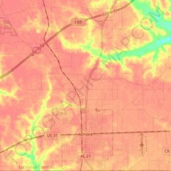
Name: Atmore topographic map, elevation, terrain.
Location: Atmore, Escambia County, Alabama, United States (30.99764 -87.54339 31.11941 -87.44295)
Average elevation: 86 m
Minimum elevation: 45 m
Maximum elevation: 97 m
Thank you for supporting this site ❤️
Make a donation
Make a donation