
Naragiri topographic map
Click on the map to display elevation.
About this map
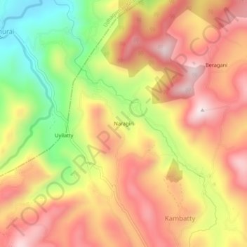
Name: Naragiri topographic map, elevation, terrain.
Location: Naragiri, Kotagiri, Nilgiris, Tamil Nadu, 643206, India (11.44793 76.82580 11.48793 76.86580)
Average elevation: 1,786 m
Minimum elevation: 1,468 m
Maximum elevation: 2,022 m
Other topographic maps
Click on a map to view its topography, its elevation and its terrain.