
Sundernagar topographic map
Click on the map to display elevation.
About this map
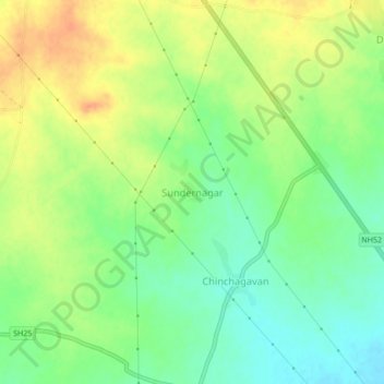
Name: Sundernagar topographic map, elevation, terrain.
Location: Sundernagar, Chalisgaon, Jalgaon, Maharashtra, 424106, India (20.59780 74.87324 20.63780 74.91324)
Average elevation: 351 m
Minimum elevation: 332 m
Maximum elevation: 372 m
Other topographic maps
Click on a map to view its topography, its elevation and its terrain.
Chalisgaon
India > Maharashtra > Chalisgaon
Chalisgaon is located at 20°28′N 75°01′E / 20.47°N 75.02°E / 20.47; 75.02. It has an average elevation of 344 metres (1128 feet).
Average elevation: 345 m