
Mooka topographic map
Interactive map
Click on the map to display elevation.
About this map
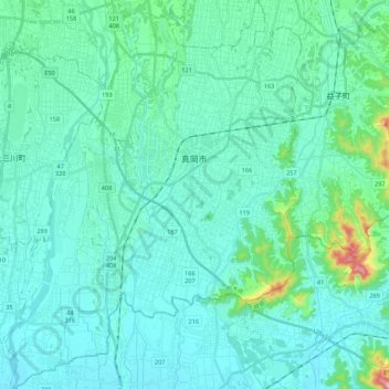
Name: Mooka topographic map, elevation, terrain.
Location: Mooka, Tochigi Prefecture, Kanto, 3214334, Japan (36.33499 139.90723 36.50998 140.07271)
Average elevation: 78 m
Minimum elevation: 34 m
Maximum elevation: 382 m
Other topographic maps
Click on a map to view its topography, its elevation and its terrain.
黒川
Japan > Tochigi Prefecture > Mibu
黒川, Mibu, Shimotsuga County, Tochigi Prefecture, Kanto, 〒321-0221, Japan
Average elevation: 64 m