
Alisas topographic map
Interactive map
Click on the map to display elevation.
About this map
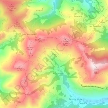
Name: Alisas topographic map, elevation, terrain.
Location: Alisas, Arredondo, Cantabria, Cantabrie, 39813, Espagne (43.27710 -3.68335 43.31710 -3.64335)
Average elevation: 505 m
Minimum elevation: 209 m
Maximum elevation: 762 m
Other topographic maps
Click on a map to view its topography, its elevation and its terrain.