
Thank you for supporting this site ❤️
Make a donation
Make a donation
Bagdola topographic map
Click on the map to display elevation.
Thank you for supporting this site ❤️
Make a donation
Make a donation
About this map
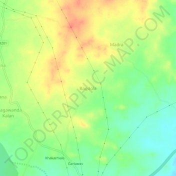
Name: Bagdola topographic map, elevation, terrain.
Location: Bagdola, Rajsamand Tehsil, Rajsamand, Rajasthan, 313324, India (25.07522 73.89881 25.11522 73.93881)
Average elevation: 565 m
Minimum elevation: 539 m
Maximum elevation: 591 m
Thank you for supporting this site ❤️
Make a donation
Make a donation