
Netaji Subash chandra Bose Park topographic map
Interactive map
Click on the map to display elevation.
About this map
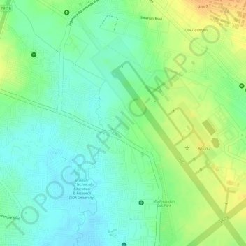
Name: Netaji Subash chandra Bose Park topographic map, elevation, terrain.
Average elevation: 34 m
Minimum elevation: 19 m
Maximum elevation: 53 m
Other topographic maps
Click on a map to view its topography, its elevation and its terrain.
Ward 43
India > Odisha > Bhubaneswar (M.Corp.) > Bhubaneswar Municipal Corporation
Average elevation: 28 m
Ward 44
India > Odisha > Bhubaneswar (M.Corp.) > Bhubaneswar Municipal Corporation
Average elevation: 21 m