
Naranjillo topographic map
Interactive map
Click on the map to display elevation.
About this map
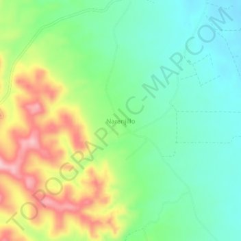
Name: Naranjillo topographic map, elevation, terrain.
Average elevation: 557 m
Minimum elevation: 491 m
Maximum elevation: 672 m
Other topographic maps
Click on a map to view its topography, its elevation and its terrain.
Tupac Katari
Bolivia > Santa Cruz > Provincia Andrés Ibáñez > Municipio La Guardia
Tupac Katari, Municipio La Guardia, Provincia Andrés Ibáñez, Santa Cruz, Bolivia
Average elevation: 584 m