
Thank you for supporting this site ❤️
Make a donation
Make a donation
Minong topographic map
Click on the map to display elevation.
Thank you for supporting this site ❤️
Make a donation
Make a donation
About this map
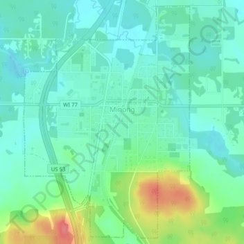
Name: Minong topographic map, elevation, terrain.
Location: Minong, Washburn County, Wisconsin, United States (46.08515 -91.84061 46.11080 -91.81403)
Average elevation: 330 m
Minimum elevation: 310 m
Maximum elevation: 383 m
Thank you for supporting this site ❤️
Make a donation
Make a donation
Other topographic maps
Click on a map to view its topography, its elevation and its terrain.