
Thank you for supporting this site ❤️
Make a donation
Make a donation
Tête de l'Étret topographic map
Click on the map to display elevation.
Thank you for supporting this site ❤️
Make a donation
Make a donation
About this map
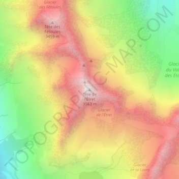
Name: Tête de l'Étret topographic map, elevation, terrain.
Average elevation: 2,878 m
Minimum elevation: 2,119 m
Maximum elevation: 3,552 m
Thank you for supporting this site ❤️
Make a donation
Make a donation
Other topographic maps
Click on a map to view its topography, its elevation and its terrain.
Glacier de la Selle
France > Auvergne-Rhône-Alpes > Isère > Saint-Christophe-en-Oisans
Average elevation: 3,110 m
Glacier du Fond
France > Auvergne-Rhône-Alpes > Isère > Saint-Christophe-en-Oisans
Average elevation: 2,850 m
Glacier de la Pilatte
France > Auvergne-Rhône-Alpes > Isère > Saint-Christophe-en-Oisans
Average elevation: 2,979 m