
Kiari topographic map
Interactive map
Click on the map to display elevation.
About this map
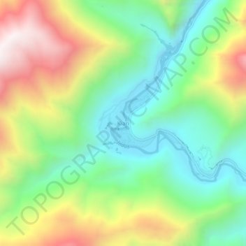
Name: Kiari topographic map, elevation, terrain.
Location: Kiari, Leh Tehsil, Leh district, Ladakh, India (33.45840 78.10831 33.49840 78.14831)
Average elevation: 4,267 m
Minimum elevation: 3,831 m
Maximum elevation: 4,979 m