
Belsele topographic map
Interactive map
Click on the map to display elevation.
About this map
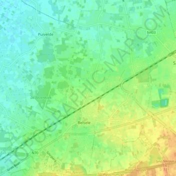
Name: Belsele topographic map, elevation, terrain.
Location: Belsele, Sint-Niklaas, Ostflandern, 9111, Belgien (51.12996 4.05861 51.18395 4.12397)
Average elevation: 13 m
Minimum elevation: 1 m
Maximum elevation: 32 m